The surveyor of the 1855 Map of Hartford County, CT was Edgar Maurice Woodford of Avon Connecticut.
=============================================================

==============================================================
He was a farmer and a part-time surveyor as a young man, but in the 1850s became a significant figure in the booming map publishing business. In five year period (1851-1856) he was the surveyor or publisher for at least forty New England town and county maps. His output included three of the large Connecticut county wall maps , Hartford (1855), Windham (1856) and Tolland (1857).
He was born in West Avon in 1824 to Zerah Woodward and Minerva Potter Woodford , and died as a soldier in 1862 during his Civil War service. (Hopkins: The Kelloggs…Vol 1; googlebooks). Also of note was his involvement in the abolition movement in the (then) Kansas Territory.
Woodford was not bashful about his role in producing this magnificent map. On the map, just south of the village of West Avon, is the entry:
“Res. of E.M. Woodford, Surveyor of the Hfd. Co. Map”.
=========================================================
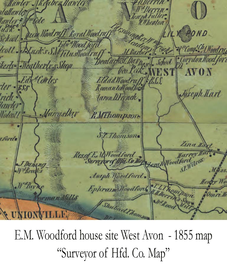
Note that across the street is the home of his father, Zerah Woodford
==============================================================================
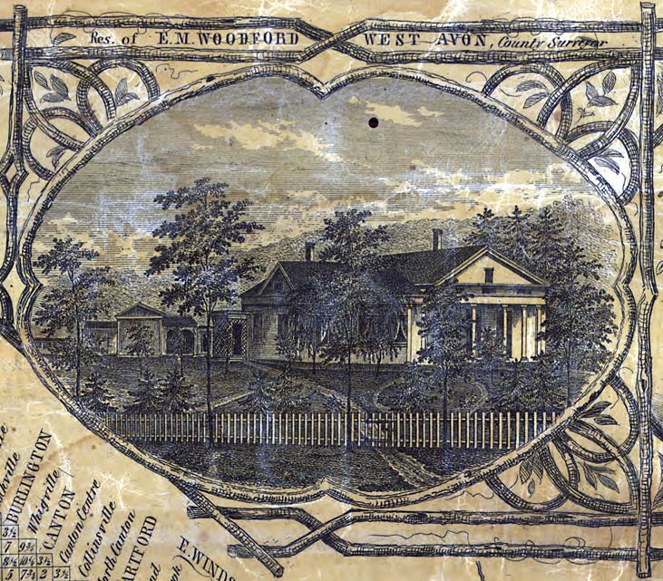
Woodford also placed a pictorial view of his house in the margin of the map. alongside pictures of hotels, the State House and the houses of prominent citizens. The map publishing business must have done well for him.
===========================================================
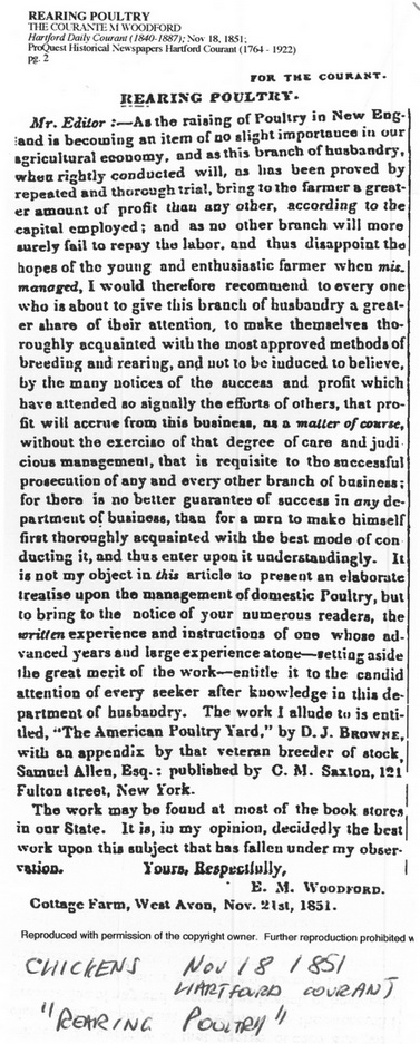
Woodford was a well educated man as were all 19th century surveyors. He wrote a long article (below) about the benefits of poultry farming in 1851, just before he discovered (we presume) the benefits of mapmaking.
==========================================================
==============================================================
That article contains a strong endorsement of a book on poultry raising, so strongly worded that I wonder if Woodford was helping to sell that book! He was listed as a farmer in the 1850 census, but in 1860 he calls himself a pedlar. That no doubt referred to his activity in publishing and selling maps. As noted above, he was most active in surveying for published town maps in 1851-1856, but he surveyed as late as 1859 (Belknap NH county map).
Of 46 published town maps with his name on them, on 27 he is the surveyor, and on 19 the publisher (sometimes with others). Almost all of his “surveyed” maps are earlier. His publishing career, where he is probably directing others in the surveying, seems to cover the period 1855-1857. Most of the maps are credited to E.M. Woodford; two are apparent partnerships with one “Bartlett”. On no map (citation) does Edgar Maurice Woodford use his full name – he is always E.M. Woodford , whether as surveyor, publisher or copyright claimant.
One of his last published maps was of Morrow County, Ohio, published in 1857 by Woodford & Bartlett. This is the only non-New England map we know of by Woodford. This seems a bit odd, as does the fact that there are no maps known by him in the following year, 1858, while he does issue the New Hampshire map in the following year (Belknap County, 1859).
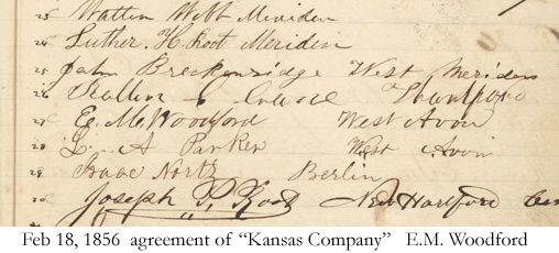
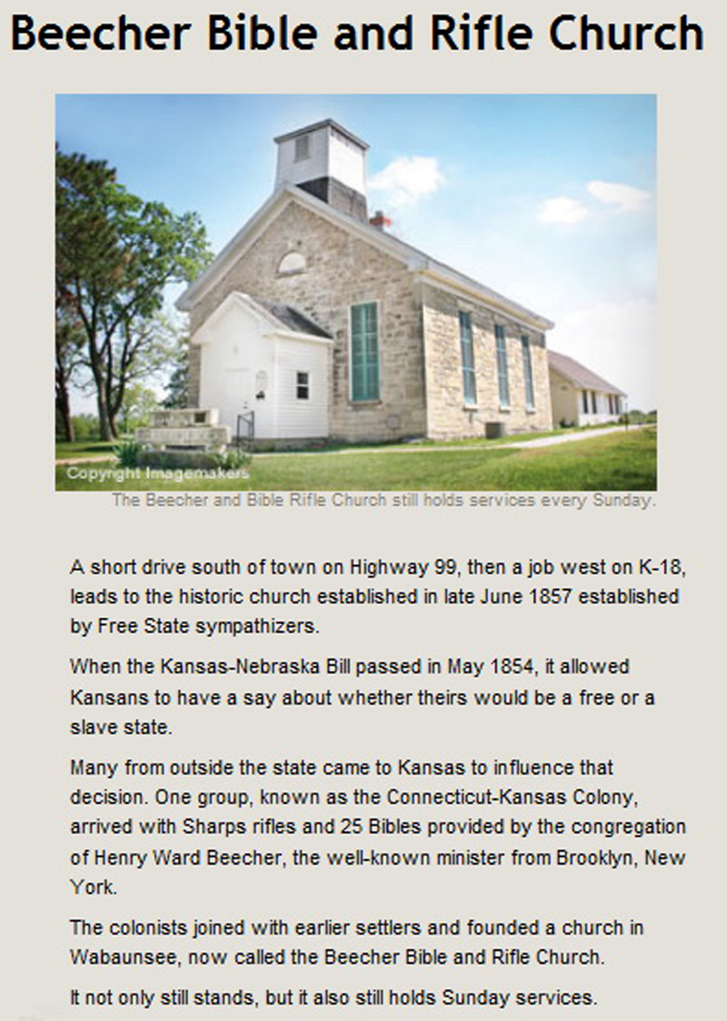
The explanation for the year-long mapping gap, and the Ohio map lies in Kansas. Edgar Woodford was in Kansas Territory for a while in 1856 and 1857. He was part of the “”Connecticut Kansas Colony”, an aboltionist group which planned to build a new settlement in Kansas Territory in support of the abolition of slavery. Kansans were deeply divided on the slavery question, and emigrants like the Connecticut colonists moved there to help shift the balance for abolition. The divisions were bitter, and force was used on both sides. Woodford’s group was also know as the Beecher Bible and Rifle Colony, for they were well armed when they went to Kansas Territory.
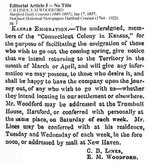
The 1857 article below from the Hartford Courant provides a glimpse of Edgar Woodford’s involvement in the project. Here he appears to be recruiting members for the second year’s settlement (the “colony” organized in the winter of 1856.)
================================================================
The Connecticut Kansas Record Book contains signatures of the colonists, including Edgar Woodford.
====================================================================
==================================================
This “Connecticut Colony” was short lived, but it was a significant element of the turmoil in Kansas leading up to the Civil War. A stone church now marks one of the emigrants’ sites, and is an historical landmark today.
================================================================
================================================================================
As noted Woodford returned to mapmaking in 1859, when his last published map was issued. In 1860 he was at home when the census taker came by and recorded him as a pedlar, probably selling county maps. The next records found to date are those leading to his death in Florida. Edgar Woodford enlisted in the Union Army in August of 1862 and died of disease a scant two months later in Jacksonville Florida. His service was in Company K, 7th Connecticut Regiment. He served in a campaign in Florida in that brief period, and held the rank of Quartermaster Sergeant at his death.
*******************************************************************
David Allen, January 2011
–Credit is due to Nora Howard Of Avon, CT and to Jefferson Moak of Philadelphia for facts and insights used in this publication.
Civil War – St. John’s Bluff Campaign
Location Map of Florida Battles
Jacksonville Occupation by Union