=============================
The Surveyor EM Woodford
Smith’s Map of Hartford County 1855 – Background Info.
On these pages we supply some interesting background information about the 1855 Hartford County Map.
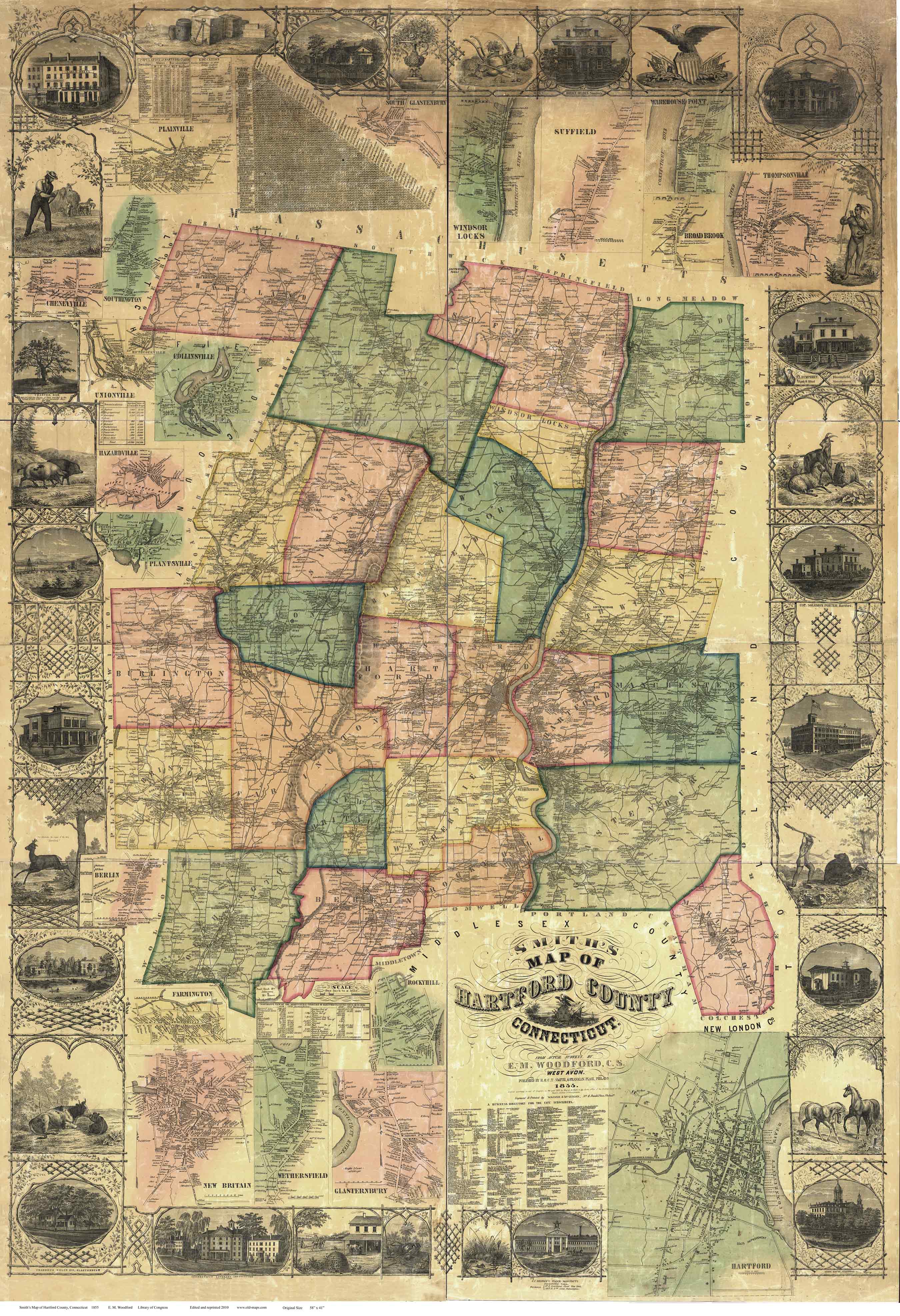
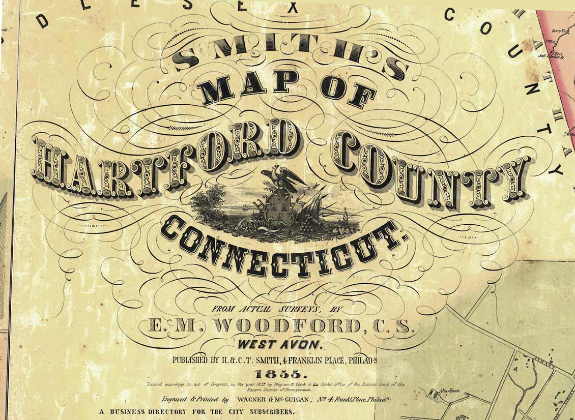
This huge wall map (5′ x 3 1/2′ ) was the first complete road map of the county. Every road and house in the rural parts of the county are shown.
=======================================================
============================================================================
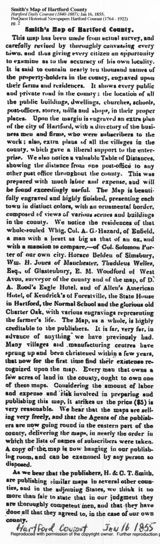
Publication Announced January 1855
This notice in the Harford Courant announced the publication of the remarkable wall map. Here we read that
“….the maps are selling very freely, and that Agents of the publisher are now …delivering the maps….”
=========================================================
This article provides several interesting facts about the 1855 county map, such as:
— Cost $5.00
— nearly 10,000 names
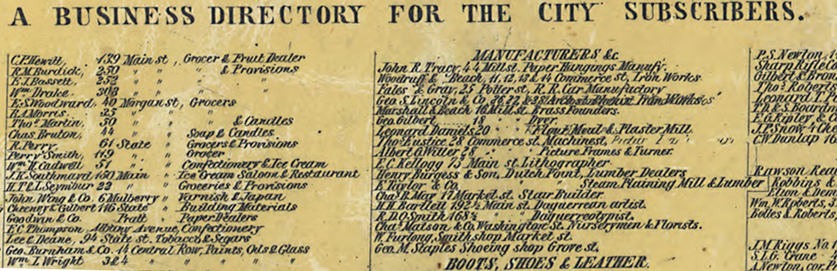
—Business Directory lists subscribers (those who paid in advance)|
=========================================================
==================================================================================
—Village detail maps provided for villages where there was “liberal support to the enterprise”
— Table of Distances considered “exceedingly useful” for this horse and buggy era.
==========================================================
Pictorial Views
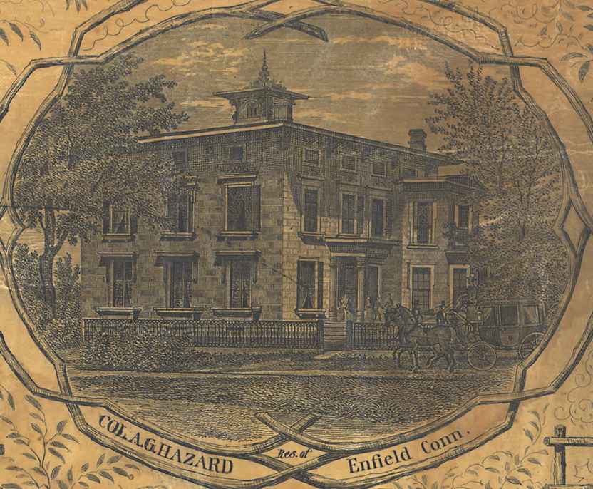
The article draws special attention to the pictorial views, first listing nine privately owned buildings. The owners paid for the engraving of their homes and businesses on the map.
The first listed was Colonel A.G. Hazard of Enfield.
“a man with a heart as big as that of an ox, and with a mansion to compare.”
=======================================================================
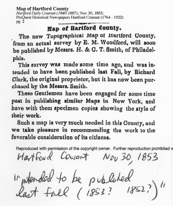
The Map was “surveyed” ca 1853
This Hartford Courant article provides some background about the map, including the fact that the surveys were done a year or two before the 1855 publication. The surveyor was a local man, Edgar M. Woodford of Avon.
============================================================================
We also learn here a clue about the involvement of Richard Clark of Philadelphia with the 1855 Hartford County map.. It is likely that Clark, a major figure in 1850s map publishing, was the principal behind the making of this map. Richard Clark is listed as the publisher of several of the earlier Connecticut town maps which E.M. Woodford surveyed, starting in 1851 when Woodford was 27 years old. The 11 Clark-Woodford town maps (1851-1853) include only one from Hartford County, which fact may suggest that Clark, who was planning to publish his Hartford County wall map in 1853, did not want any town maps to compete with the forthcoming county map. Clark ‘s name appears nowhere on the 1855 map, as he sold his interest in the Hartford County map to H. & C.T. Smith, the publishers of record. Nothing is known of these men at this time, except for the fact that they were probably from Philadelphia and their names appear on several other 1850s county maps.
David Allen January 2011
Acknowledgements: Special thanks to Nora Howard of Avon, CT for providing the old newspaper clippings cited here. The clippings are from the archives of the Hartford Courant. Jefferson Moak of Philadelphia has generously provided copies of his research into E.M. Woodford and Phildelphia mapmaking.